News round-up from Cornwallis
Funding groups boost efforts to control predators and boost local birdlife
Three organisations that help support local environment projects are helping to try and make Cornwallis predator free.
Those groups are the Waitakere Ranges Local Board, the EcoMatters Trust and its 'Love Your Neighbourhood assistance program', and PestFree NZ.

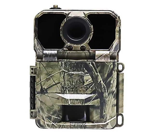
 Funds from the Waitakere Ranges Local Board and the EcoMatters Trust will be used to purchase SIM cards for the trail cameras (pictured below) monitoring a colony of grey-faced petrels at the southern tip of the Cornwallis peninsula. The two groups also funded one of the monitoring cameras, with the second one purchased with funds from PestFree NZ
The camera equipment allows for continuous monitoring of petrel activity and recording any predator incursions from rats, mice, stoats or hedgehogs. Video clips of animals moving are taken during the day or night.
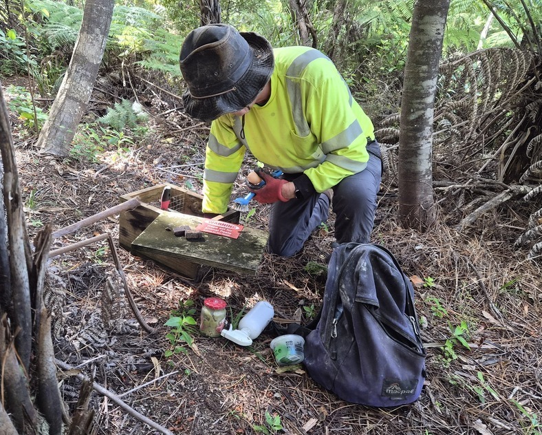
The funding will also be used to buy backpacks and supplies to help volunteers maintain the trap lines.
A control programme targeting rats, mice, stoats and possums has been running on the peninsula for over 10 years now and was extended a few years ago to include the land west of the Kakamatua Inlet.
The total area under control is 310 hectares, of which privately owned land and dwellings makes up just 10%.
 Some predator activity is still being recorded at the southern tip of the peninsula on Puponga Point, the location of the grey-faced petrel colony, however control programme organisers believe the predator threat is under control there and petrel colony is slowly growing.
With fewer rats, stoats and mice on the peninsula, invertebrates such as weta and the numerous bird species (including penguins and grey-faced petrels) that were once prolific in the area, are beginning a slow recovery. At least a third of local fledgling petrel chicks are estimated to make it through to adulthood, which is considered good for a land-based colony.
The control work is being carried out by local community group SCOW, which originally formed to “Save Cornwallis’ Old Wharf”, but now works to help maintain and upgrade assets throughout the peninsula. This includes helping with such issues as removing graffiti from the wharf, communicating with Auckland Council on stormwater drain clearance and lobbying for better footpaths along Cornwallis Road.
A sub-group of SCOW, known as the Petrelheads – due to its work in protecting the grey-faced petrel colony on the southern tip of the peninsula – currently organises the control work, with financial support groups such as the Waitakere Ranges Local Board, PestFree NZ and the EcoMatters Trust.
Alex Duncan of the Petrelheads says they are indebted to those people who regularly check trap lines each month or so, but they are also looking for more volunteers to help with this work. If you are interested, you can email pestfreecornwallis@gmail.com for more information.
The Petrelheads work alongside a similar team in nearby Huia that is also doing predator control work.
Cornwallis Beach Tweets
Another beautiful day out in the Waitakere Ranges. Today we climbed to the McLachlan Monument above Cornwallis beach on the Karangahape Peninsula. pic.twitter.com/keG9axAzZt
— Chris Pook (@drchrispook) September 22, 2024
<blockquote class="twitter-tweet"><p lang="en" dir="ltr">Another beautiful day out in the Waitakere Ranges. Today we climbed to the McLachlan Monument above Cornwallis beach on the Karangahape Peninsula. <a href="https://t.co/keG9axAzZt">pic.twitter.com/keG9axAzZt</a></p>— Chris Pook (@drchrispook) <a href="https://twitter.com/drchrispook/status/1837724322762576177?ref_src=twsrc%5Etfw">September 22, 2024</a></blockquote> <script async src="https://platform.twitter.com/widgets.js" charset="utf-8"></script>
Fish and chips with the family in one of Aucklands best spots tonight, Cornwallis Beach :)#LoveTheWest pic.twitter.com/jTgI5bT4Gs
— Cr Shane Henderson (@HendoWest) January 23, 2025
Photographed by Donald Jenkins 100 years ago in 1924, this image of #CornwallisBeach is part of the Auckland Libraries Heritage Collection. pic.twitter.com/KPuXumC3AT
— Cornwallis Beach (@Cornwallis_NZ) August 11, 2024
A spectacular view of the #sunrise over the pier at Cornwallis Beach #NewZealand.#landscapephotography #seascape #photography pic.twitter.com/N4ACWEHxER
— Jacques Olivier (@WanderingPlank) May 24, 2023
Looking south from the northern end of #CornwallisBeach - Photo taken February 1969 by John Thomas Diamond, part of the Auckland Libraries Heritage Collection. pic.twitter.com/85JebdPHnH
— Cornwallis Beach (@Cornwallis_NZ) May 16, 2023
— Cornwallis Beach (@Cornwallis_NZ) August 9, 2022
- Buy a trap
- Cornwallis high and low tide chart
- Fishing tides for Manukau Harbour
- Is Cornwallis safe for swimming?
- Facilities at Cornwallis Beach
- MPI fish and shellfish regulations
- Waitākere Ranges Local Board
- Manukau Harbour Restoration Society
- Detailed swell map for region
- Huia Settlers Museum website
- Huia & Cornwallis Ratepayers Assoc.


